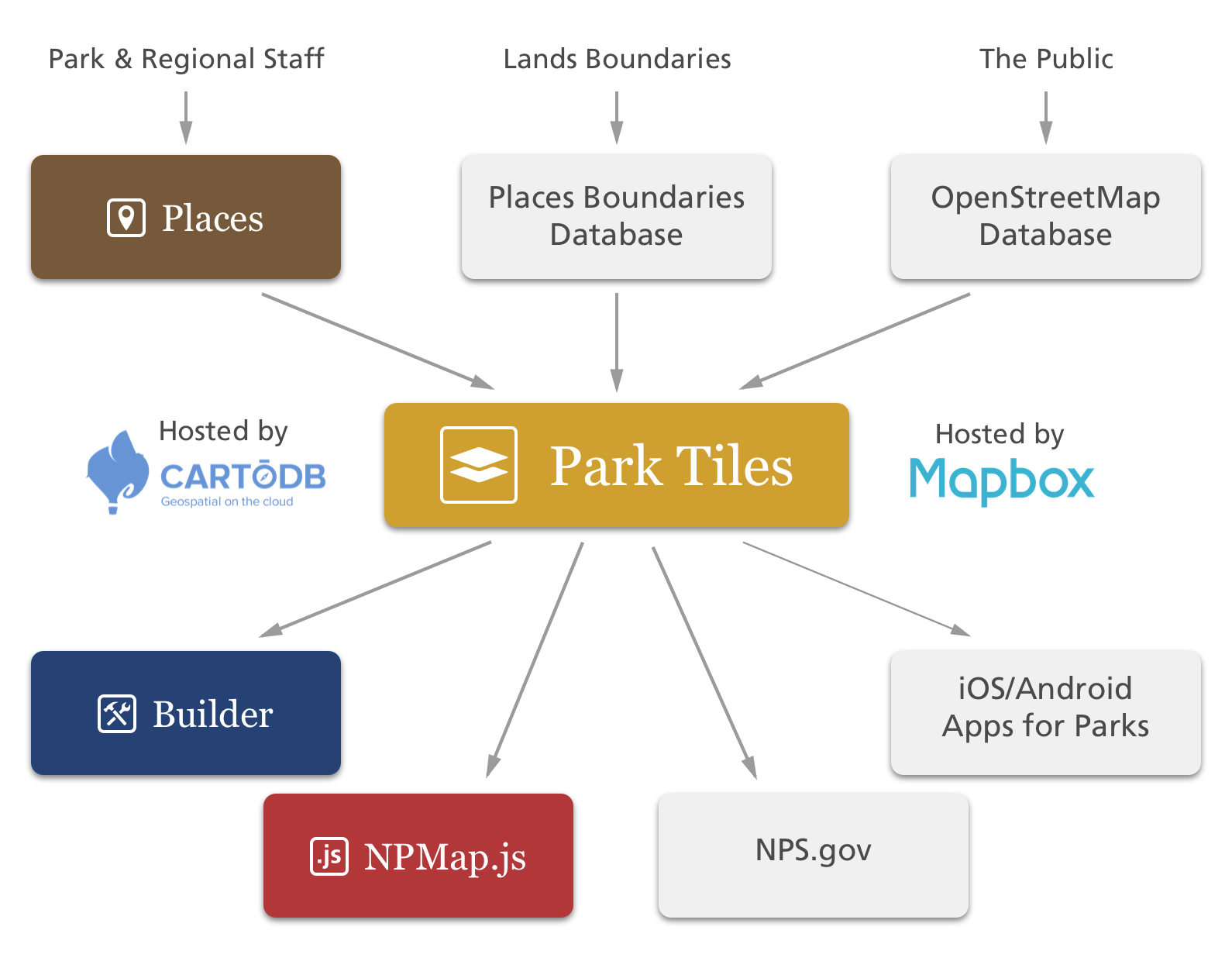
From Places
to Park Tiles
           ,--.  ,--.        ,--.,--.    ,--.       ,--.                   ,--.
           |  ,'.|  |,--.,--.|  ||  |    |  | ,---. |  | ,--,--.,--,--,  ,-|  |
           |  |' '  ||  ||  ||  ||  |    |  |(  .-' |  |' ,-.  ||      \' .-. |
           |  | `   |'  ''  '|  ||  |    |  |.-'  `)|  |\ '-'  ||  ||  |\ `-' |
           `--'  `--' `----' `--'`--'    `--'`----' `--' `--`--'`--''--' `---'

,--.  ,--.          ,--.  ,--.                       ,--.    ,------.                ,--.
|  ,'.|  | ,--,--.,-'  '-.`--' ,---. ,--,--,  ,--,--.|  |    |  .--. ' ,--,--.,--.--.|  |,-.
|  |' '  |' ,-.  |'-.  .-',--.| .-. ||      \' ,-.  ||  |    |  '--' |' ,-.  ||  .--'|     /
|  | `   |\ '-'  |  |  |  |  |' '-' '|  ||  |\ '-'  ||  |    |  | --' \ '-'  ||  |   |  \  \
`--'  `--' `--`--'  `--'  `--' `---' `--''--' `--`--'`--'    `--'      `--`--'`--'   `--'`--'
╔═════════════════════════════════════════════════════════╗
║             .▄▄▄  ▄• ▄▌▄▄▄ ..▄▄ ·▄▄▄▄▄                  ║
║             ▐▀•▀█ █▪██▌▀▄.▀·▐█ ▀.•██                    ║
║             █▌·.█▌█▌▐█▌▐▀▀▪▄▄▀▀▀█▄▐█.▪                  ║
║             ▐█▪▄█·▐█▄█▌▐█▄▄▌▐█▄▪▐█▐█▌·                  ║
║             ·▀▀█.  ▀▀▀  ▀▀▀  ▀▀▀▀ ▀▀▀                   ║
╟─────────────────────────────────────────────────────────╢
║         The President has signed a bill declaring       ║
║          Null Island National Park as the newest        ║
║          Unit of the National Park Service!             ║
║                                                         ║
║         Your team, NPMap, has been tasked with          ║
║         collecting data for this park and making        ║
║        a beautiful online map for visitors using        ║
║          only Open Source Tools and services.           ║
╚═════════════════════════════════════════════════════════╝

╔═════════════════════════════════════════════════════════╗
║ Full Name: Jimmy Rocks                                  ║
║ Position: Developer                                     ║
╟────────┬────────────────────────────────────────────────╢
║ Skills │                                                ║
╟────────┘                                                ║
║                                                         ║
║ Node.js....................░░░▒▒▒▒▒▒▓▓▓          4/5    ║
║                                                         ║
║ Bourne Again Shell.........░░░▒▒▒▒▒▒             3/5    ║
║                                                         ║
║ Sequential Query Language..░░░▒▒▒▒▒▒▓▓▓          4/5    ║
║                                                         ║
║ OpenStreetMap..............░░░▒▒▒▒▒▒▓▓▓███       5/5    ║
║                                               ♥︎ ♥︎ ♥︎ ♥︎ ♥︎ ║
╚═════════════════════════════════════════════════════════╝
╔═════════════════════════════════════════════════════════╗
║               ________  ___  _    __                    ║
║                | |/ / \/ / \| |  ( (`                   ║
║                |_|\_\_/\_\_/|_|___)_)                   ║
╟─────────────────────────────────────────────────────────╢
║                                                         ║
║ Mapbox:   Provides hosting for our vector tiles         ║
║                                                         ║
║ CartoDB:   Online Database with fast dynamic querying   ║
║                                                         ║
║ OpenStreetMap:    iD Editor & JOSM for collecting data  ║
║                                                         ║
║ Internal:   Park, Regional, and Federal GIS Departments ║
║                                               ♥︎ ️♥︎ ♥︎ ♥︎ ♥︎ ║
╚═════════════════════════════════════════════════════════╝
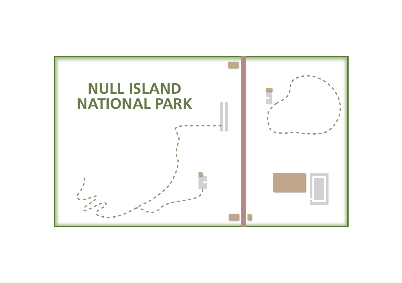
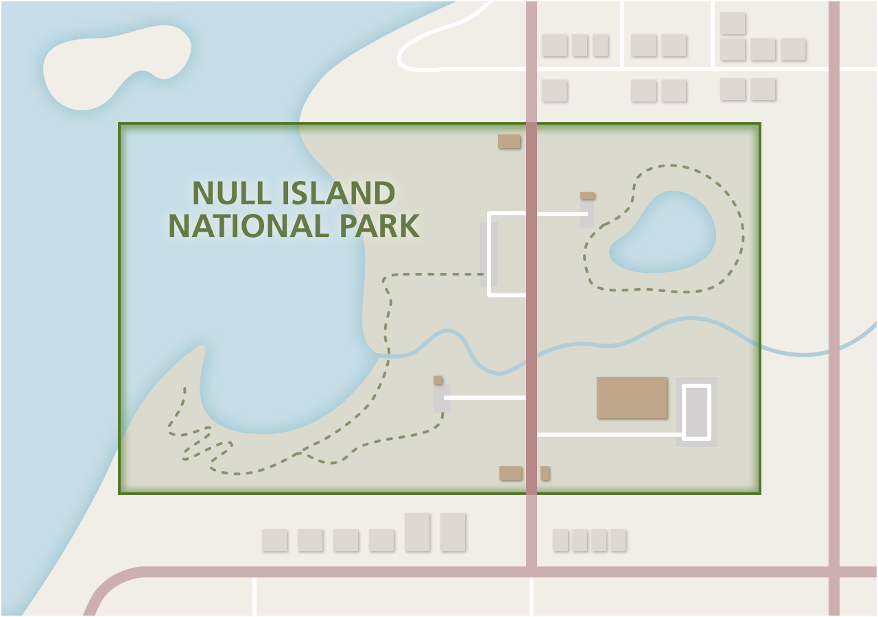
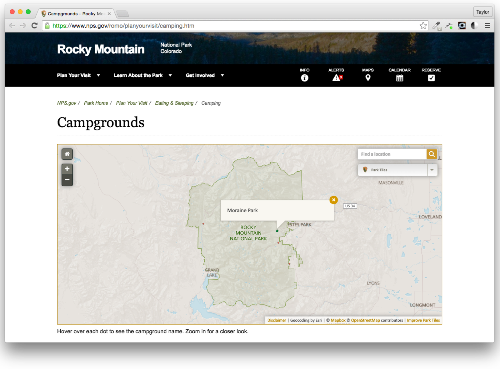
╔═════════════════════════════════════════════════════════╗
║ Where Is Null Island National Park?                     ║
╟─────────────────────────────────────────────────────────╢
║                                                         ║
║ Player #3 (Chad Lawlis) is on the task!                 ║
║                                                         ║
║   Chad works with the legislative & interpretive        ║
║     boundaries.                                         ║
║                                                         ║
║   He determines a boundary to be used on the web map.   ║
║                                                         ║
║   This boundary will be stored in a PostGIS database    ║
║     that is synchronized to CartoDB every evening.      ║
║                                               ♥︎ ♥︎ ♥︎ ♥︎ ♥︎ ║
╚═════════════════════════════════════════════════════════╝
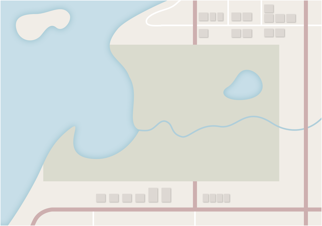
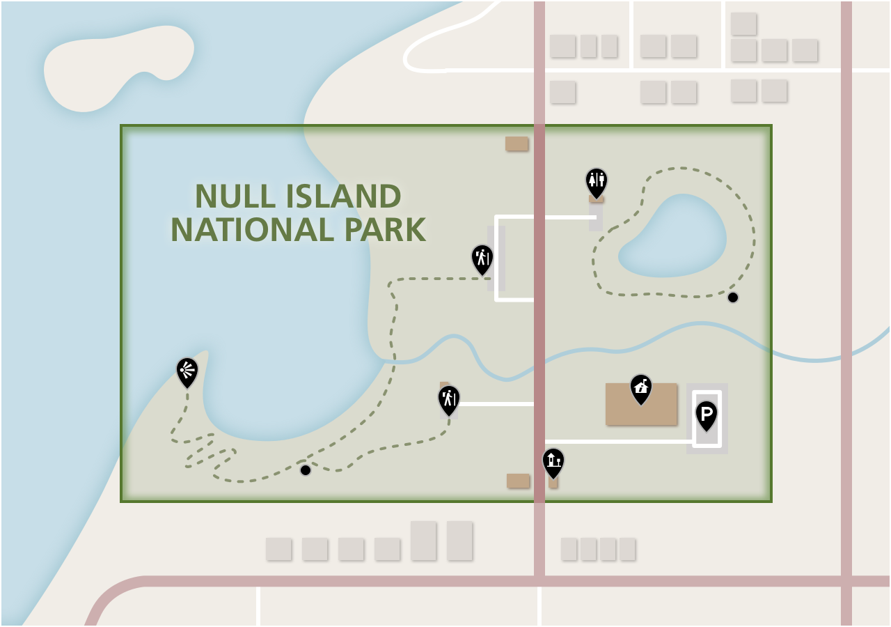
╔═════════════════════════════════════════════════════════╗
║ Gathering the Features ║
╟─────────────────────────────────────────────────────────╢
║ ║
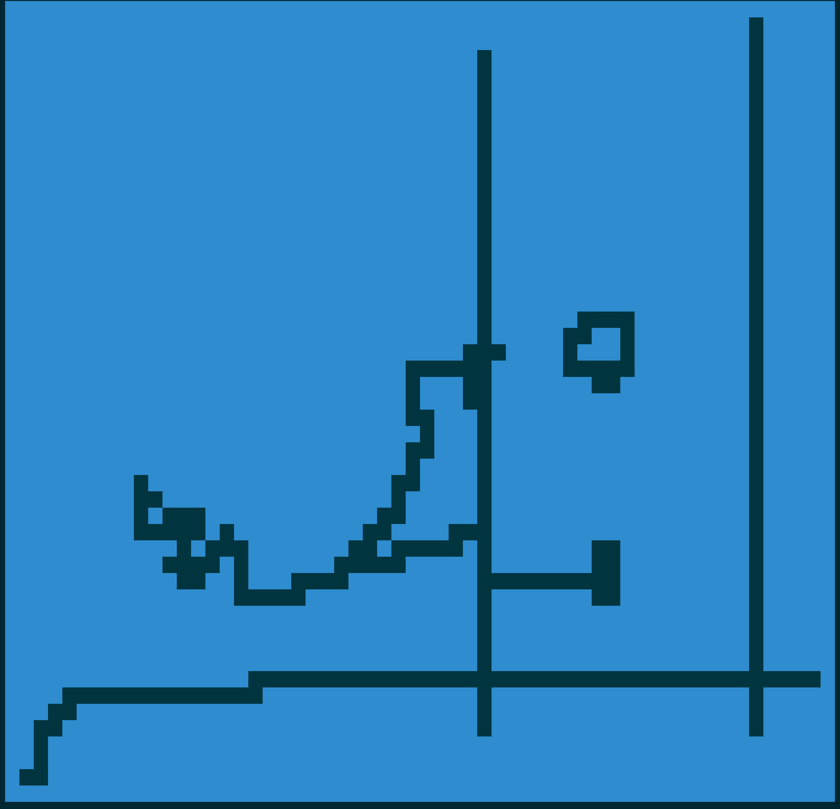
║ Roads ║
║ ║
║ Trails ║
║ ║
║ ♥︎ ♥︎ ♥︎ ♥︎ ♥︎ ║
╚═════════════════════════════════════════════════════════╝
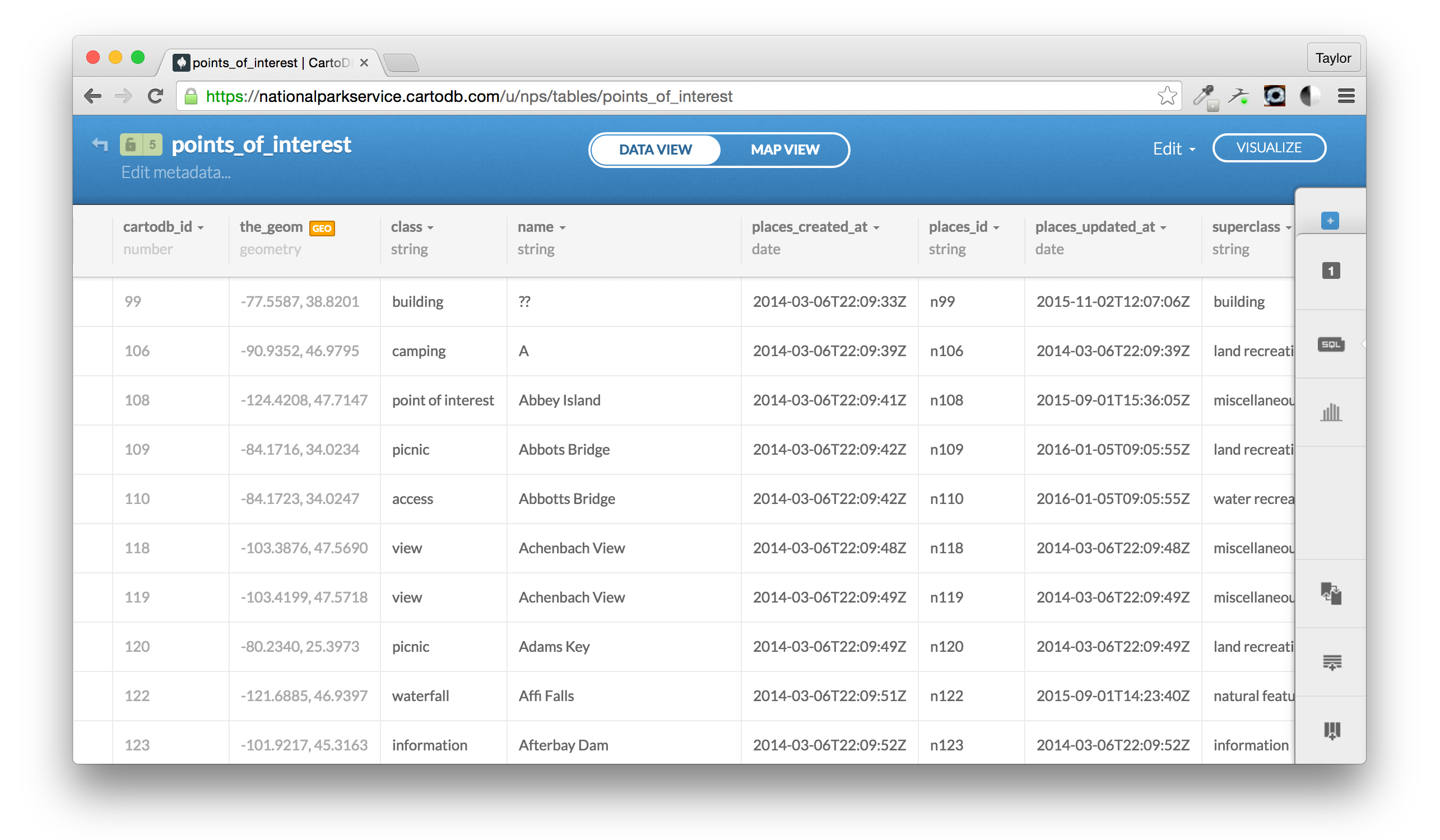
╔═════════════════════════════════════════════════════════╗
║ Gathering the Features ║
╟─────────────────────────────────────────────────────────╢
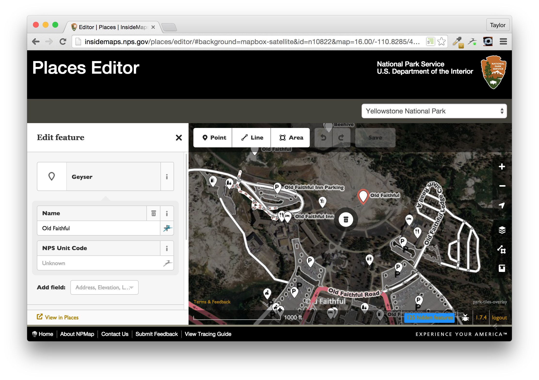
║ NPMap has a great tool called Places ║
║ ║
║ Places allows people in the National Park Service to ║
║ Create-Read-Update-Delete data displayed on the map ║
║ within Parks. ║
║ ║
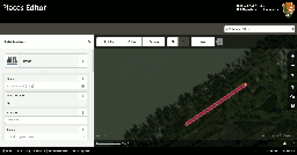
║ Rangers at Null Island National Park took GPS tracks ║
║ of Roads and Trails within the Park, and used the ║
║ iD Editor to digitize the data. ║
║ ♥︎ ♥︎ ♥︎ ♥︎ ♥︎ ║
╚═════════════════════════════════════════════════════════╝
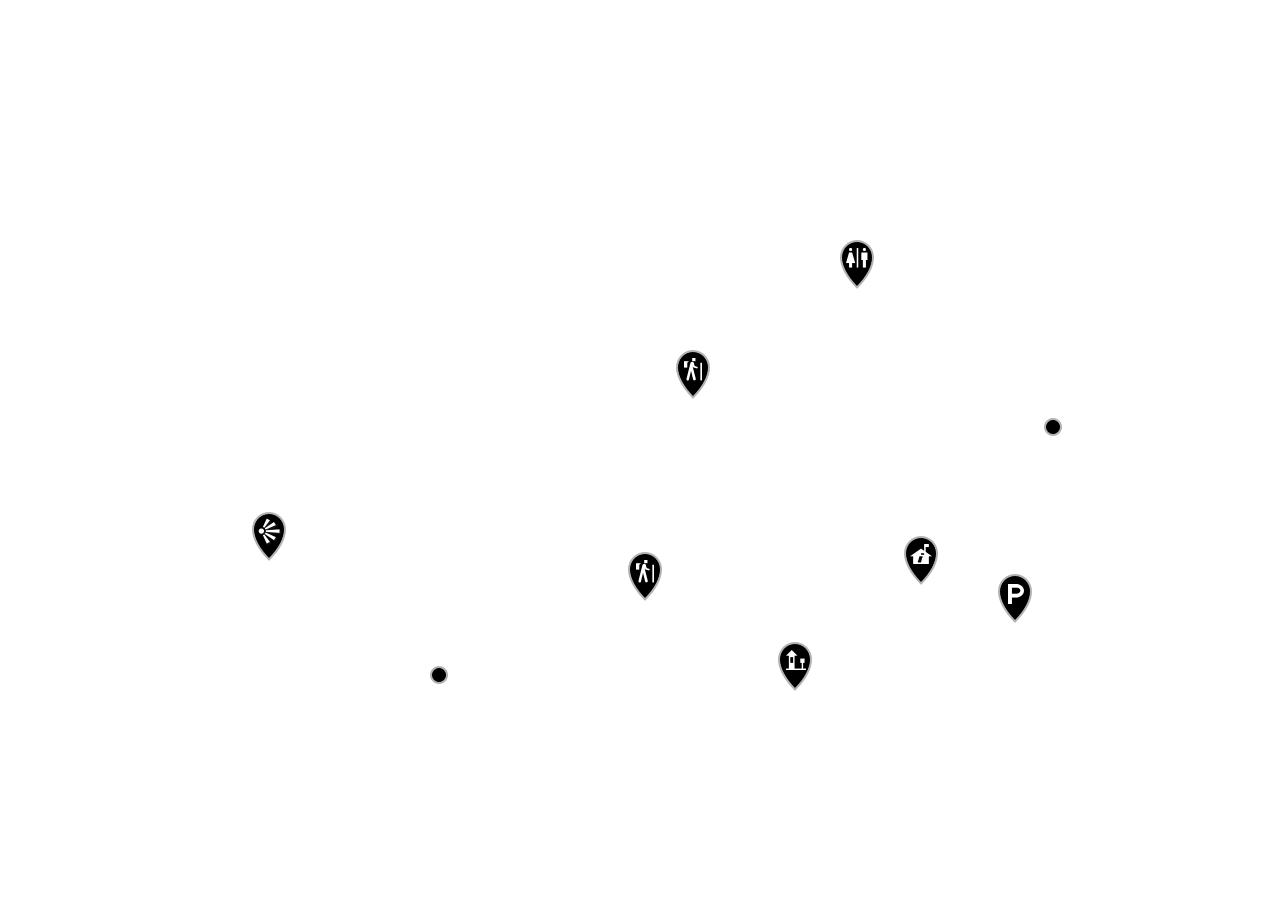
╔═════════════════════════════════════════════════════════╗
║                 Gathering the Features                  ║
╟─────────────────────────────────────────────────────────╢
║                                                         ║
║                   Building Footprints                   ║
║                                                         ║
║                      Parking Lots                       ║
║                                                         ║
║                    Points Of Interest                   ║
║                                               ♥︎ ️♥︎ ♥︎ ♥︎ ♥︎ ║
╚═════════════════════════════════════════════════════════╝
╔═════════════════════════════════════════════════════════╗
║          ___           _   _  _                         ║
║         | _ ) __ _  __| | | \| | ___ __ __ __ ___       ║
║         | _ \/ _` |/ _` | | .` |/ -_)\ V  V /(_-<       ║
║         |___/\__,_|\__,_| |_|\_|\___| \_/\_/ /__/       ║
╟─────────────────────────────────────────────────────────╢
║                                                         ║
║    The features are stored in an closed source format!  ║
║                                                         ║
║   You will need to convert to the OpenStreetMap format. ║
║                                                         ║
║                     Lose One Health                     ║
║                                                 ♥︎ ♥︎ ♥︎ ♥︎ ║
╚═════════════════════════════════════════════════════════╝
╔═════════════════════════════════════════════════════════╗
║           Building a Synchronization Tool               ║
╟─────────────────────────────────────────────────────────╢
║                                                         ║
║ You must:                                               ║
║   Determine "TRANSLATIONS" in order to use closed       ║
║   source data alongside OpenStreetMap data.             ║
║                                                         ║
║ Convert data from closed source into a format           ║
║   compatible with OpenStreetMap.                        ║
║                                                         ║
║ Keep a detailed log track of all updates to make sure   ║
║   changes are replicated .                              ║
║                                                   ♥︎ ♥︎ ♥︎ ║
╚═════════════════════════════════════════════════════════╝
╔═════════════════════════════════════════════════════════╗
║________   __   _     __  _     __ ______  ___  _     __ ║
║ | || |_) / /\ | |\ |( (`| |   / /\ | || |/ / \| |\ |( ('║
║ |_||_| \/_/--\|_| \|_)_)|_|__/_/--\|_||_|\_\_/|_| \|_)_)║
╟─────────────────────────────────────────────────────────╢
║   You are required to spend many many months working    ║
║  with standards committees and stakeholders in Parks.   ║
║                                                         ║
║  You must use these resources to determine how to use   ║
║  OpenStreetMap tags to represent everything needed for  ║
║               National Park Service Map.                ║
║                                                       ♥︎ ║
╚═════════════════════════════════════════════════════════╝
╔═════════════════════════════════════════════════════════╗
║       ___               _   _  _                        ║
║      / __| ___  ___  __| | | \| | ___ __ __ __ ___      ║
║     | (_ |/ _ \/ _ \/ _` | | .` |/ -_)\ V  V /(_->      ║
║      \___|\___/\___/\__,_| |_|\_|\___| \_/\_/ /__/      ║
╟─────────────────────────────────────────────────────────╢
║                                                         ║
║   The Closed Source Data Format has a featured called   ║
║      "Editor Tracking", it will keep a log when         ║
║                    changes are made.                    ║
║                                                         ║
║   The Closed Source company offers a tool to convert    ║
║      their data to into the GeoJSON format called       ║
║      Terraformer, this will make it easy to use!        ║
║                                                     ♥︎ ♥︎ ║
╚═════════════════════════════════════════════════════════╝
╔═════════════════════════════════════════════════════════╗
║      _,, __, _ _,_,___, _,_, _ ____,_,___ _ _,_, _      ║
║     (_ \ ||\ |/ `|_||_)/ \|\ | |` //_\ |  |/ \|\ |      ║
║     , ) \|| \|\ ,| || \\ /| \| | / | | |  |\ /| \|      ║
║      ~   )~  ~ ~ ~ ~~ ~ ~ ~  ~ ~~~~~ ~ ~  ~ ~ ~  ~      ║
║         ~'                                              ║
╟─────────────────────────────────────────────────────────╢
║                                                         ║
║         You can get to work building a process!         ║
║                                                         ║
║     You will read all data updated from the source      ║
║             source since the last sync.                 ║
║                                                         ║
║    You will then compare these updates with data that   ║
║      has already been synchronized to determine if      ║
║                 any records were deleted.               ║
║                                                   ♥︎ ♥︎ ♥︎ ║
╚═════════════════════════════════════════════════════════╝
╔═════════════════════════════════════════════════════════╗
║      _,, __, _ _,_,___, _,_, _ ____,_,___ _ _,_, _      ║
║     (_ \ ||\ |/ `|_||_)/ \|\ | |` //_\ |  |/ \|\ |      ║
║     , ) \|| \|\ ,| || \\ /| \| | / | | |  |\ /| \|      ║
║      ~   )~  ~ ~ ~ ~~ ~ ~ ~  ~ ~~~~~ ~ ~  ~ ~ ~  ~      ║
║         ~'                                              ║
╟─────────────────────────────────────────────────────────╢
║                                                         ║
║    1)  Remove deleted records                           ║
║    2)  Convert the Updates to the correct format        ║
║        (OpenStreetMap XML)                              ║
║    3)  push the records into the database               ║
║                                                 ♥︎ ♥︎ ♥︎ ♥︎ ║
╚═════════════════════════════════════════════════════════╝

╔═════════════════════════════════════════════════════════╗
║              ·▄▄▄▄• ▄▌▄▄▄▄▄▄• ▄▌▄▄▄  ▄▄▄ .              ║
║              ▐▄▄·█▪██▌•██  █▪██▌▀▄ █·▀▄.▀·              ║
║              ██▪ █▌▐█▌ ▐█.▪█▌▐█▌▐▀▀▄ ▐▀▀▪▄              ║
║              ██▌.▐█▄█▌ ▐█▌·▐█▄█▌▐█•█▌▐█▄▄▌              ║
║              ▀▀▀  ▀▀▀  ▀▀▀  ▀▀▀ .▀  ▀ ▀▀▀               ║
║           • ▌ ▄ ·. ▪  .▄▄ · .▄▄ · ▪         ▐ ▄         ║
║           ·██ ▐███▪██ ▐█ ▀. ▐█ ▀. ██ ▪     •█▌▐█        ║
║           ▐█ ▌▐▌▐█·▐█·▄▀▀▀█▄▄▀▀▀█▄▐█· ▄█▀▄ ▐█▐▐▌        ║
║           ██ ██▌▐█▌▐█▌▐█▄▪▐█▐█▄▪▐█▐█▌▐█▌.▐▌██▐█▌        ║
║           ▀▀  █▪▀▀▀▀▀▀ ▀▀▀▀  ▀▀▀▀ ▀▀▀ ▀█▄▀▪▀▀ █▪        ║
╟─────────────────────────────────────────────────────────╢
║                                                         ║
║                      REPEAT OFTEN                       ║
║                                                 ♥︎ ♥︎ ♥︎ ♥︎ ║
╚═════════════════════════════════════════════════════════╝
╔═════════════════════════════════════════════════════════╗
║  ___         _           ___            _               ║
║ |   \  __ _ | |_  __ _  | _ \ ___ __ __(_) ___ __ __ __ ║
║ | |) |/ _` ||  _|/ _` | |   // -_)\ V /| |/ -_)\ V  V / ║
║ |___/ \__,_| \__|\__,_| |_|_\\___| \_/ |_|\___| \_/\_/  ║
╟─────────────────────────────────────────────────────────╢
║                                                         ║
║ Sources:                                                ║
╟─────────────────┬─────────────────┬─────────────────────╢
║  Other Players  │ Digitized in iD │ Sync'ed from Source ║
╟─────────────────┼─────────────────┼─────────────────────╢
║ Park Boundaries │ Trails          │ Buildings           ║
║                 │ Roads           │ Parking Lots        ║
║                 │                 │ Points of Interest  ║
╟─────────────────┴─────────────────┴─────────────────────╢
║                                                         ║
║                                               ♥︎ ♥︎ ♥︎ ♥︎ ♥︎ ║
╚═════════════════════════════════════════════════════════╝
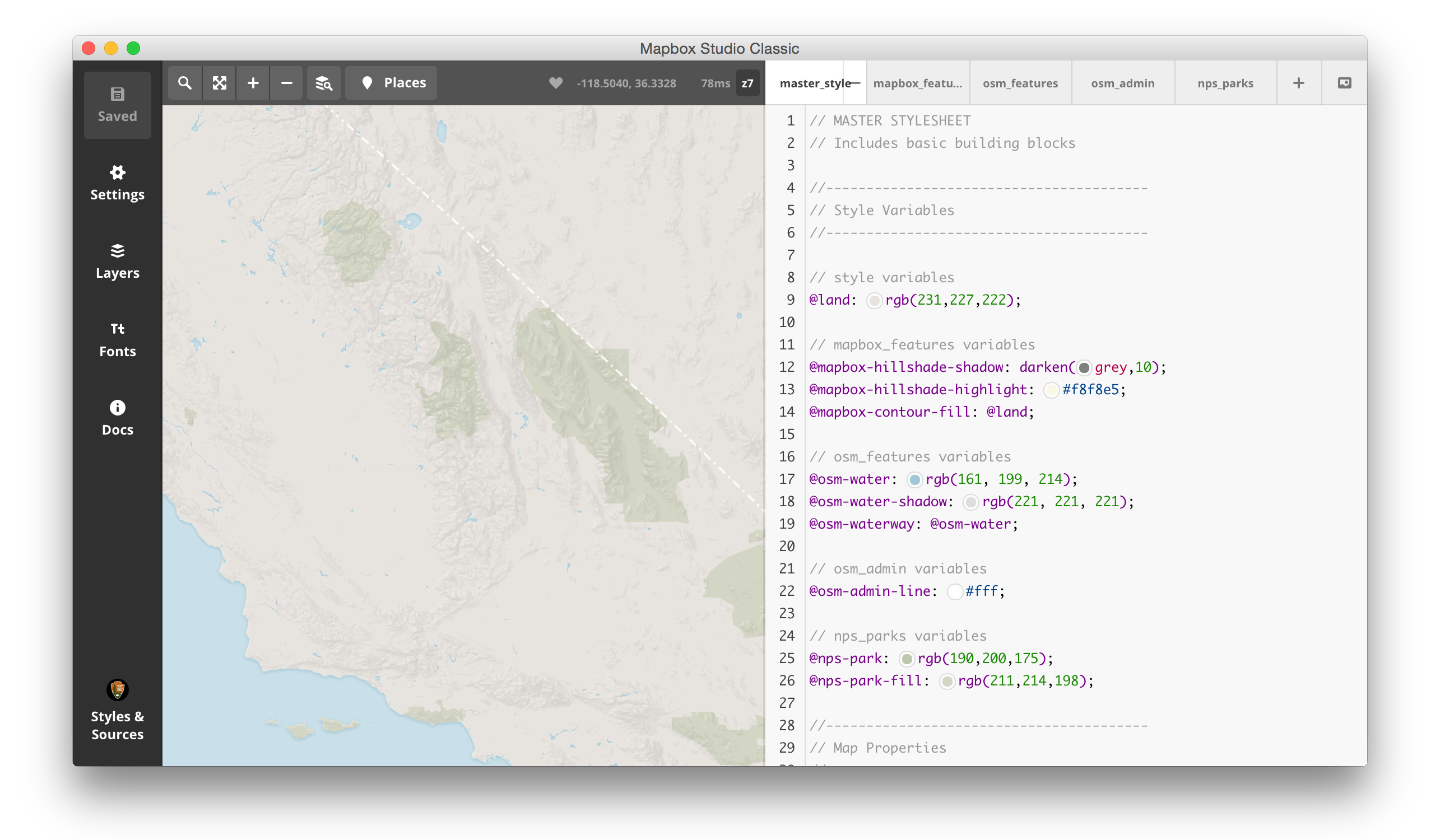
╔═════════════════════════════════════════════════════════╗
║   #####                                            ###  ║
║  #     # #    #  ####   ####  ######  ####   ####  ###  ║
║  #       #    # #    # #    # #      #      #      ###  ║
║   #####  #    # #      #      #####   ####   ####   #   ║
║        # #    # #      #      #           #      #      ║
║  #     # #    # #    # #    # #      #    # #    # ###  ║
║   #####   ####   ####   ####  ######  ####   ####  ###  ║
╟─────────────────────────────────────────────────────────╢
║  Next Steps:                                            ║
║                                                         ║
║ * Use an all-SQL version of OpenStreetMap’s osm2pgsql   ║
║   to convert the OpenStreetMap data into PostGIS.       ║
║                                                         ║
║ * Use Mapbox Studio Classic to render the Line and      ║
║   Polygon Data into Vector Tiles.                       ║
║                                               ♥︎ ♥︎ ♥︎ ♥︎ ♥︎ ║
╚═════════════════════════════════════════════════════════╝
╔═════════════════════════════════════════════════════════╗
║   #####                                            ###  ║
║  #     # #    #  ####   ####  ######  ####   ####  ###  ║
║  #       #    # #    # #    # #      #      #      ###  ║
║   #####  #    # #      #      #####   ####   ####   #   ║
║        # #    # #      #      #           #      #      ║
║  #     # #    # #    # #    # #      #    # #    # ###  ║
║   #####   ####   ####   ####  ######  ####   ####  ###  ║
╟─────────────────────────────────────────────────────────╢
║  Next Steps:                                            ║
║                                                         ║
║ * Use the same sync tool load data from PostGIS into    ║
║   CartoDB, who will now host the Point Data.            ║
║                                                         ║
║ * Allow the Cartography team to transform the raw       ║
║   data into a visitor facing multiscale map.            ║
║                                               ♥︎ ♥︎ ♥︎ ♥︎ ♥︎ ║
╚═════════════════════════════════════════════════════════╝